Mapping our way through eastern US is more familiar than foreign to us – soon we will be west of the mighty Mississippi and into some uncharted territory.
We have experienced some challenges and encountered some pleasant surprises along the route. As I noted, the RIVIAN navigation system it super smart – like wicked smaht. At first it was easy to just rely on what the truck suggested. As we left the Shenandoah Valley, we became a bit more adventurous and enjoyed passing the time studying the atlas spread across my lap. We would map our path through an entire county, state, and region.

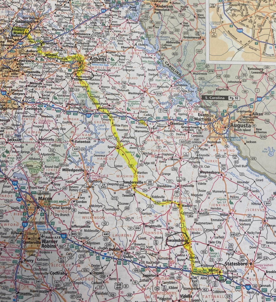
Recently, on our way to a one night campsite at Old Federal Campground on Lake Lanier. I decided I would record the navigation in an attempt to plot out our route on the road atlas. I filled two pages of route turns and landmarks! We left Savannah and headed north on Rt 16 toward Atlanta. This US route is a passageway uniting east to west in Georgia. Our intention was to continue on to Macon and visit the Ocmulgee Mounds National Historical Park. However, after our charging stop and with no luck finding a state forest campsite, we took the recommendation of some locals and left the route most travelled. We began our trek to Flowery Branch.
We clocked 270 miles of rolling roads and country turns on US 1 SR 4 SR 57 through Swainsboro US 319 through Wadley onto SR 78 at Calhoun, turning onto Friendship Church Road on our way to Sparta on SR231 back along US 16 along Traditions Highway and into Siloam on SR 22 to US 15 to SR 77 and the junction of US 20 and historic Greensboro.
We are getting close enough to look for a grocery store to stock up on supplies for the evening. So we stopped at the local grocery Moon’s Supermarket.

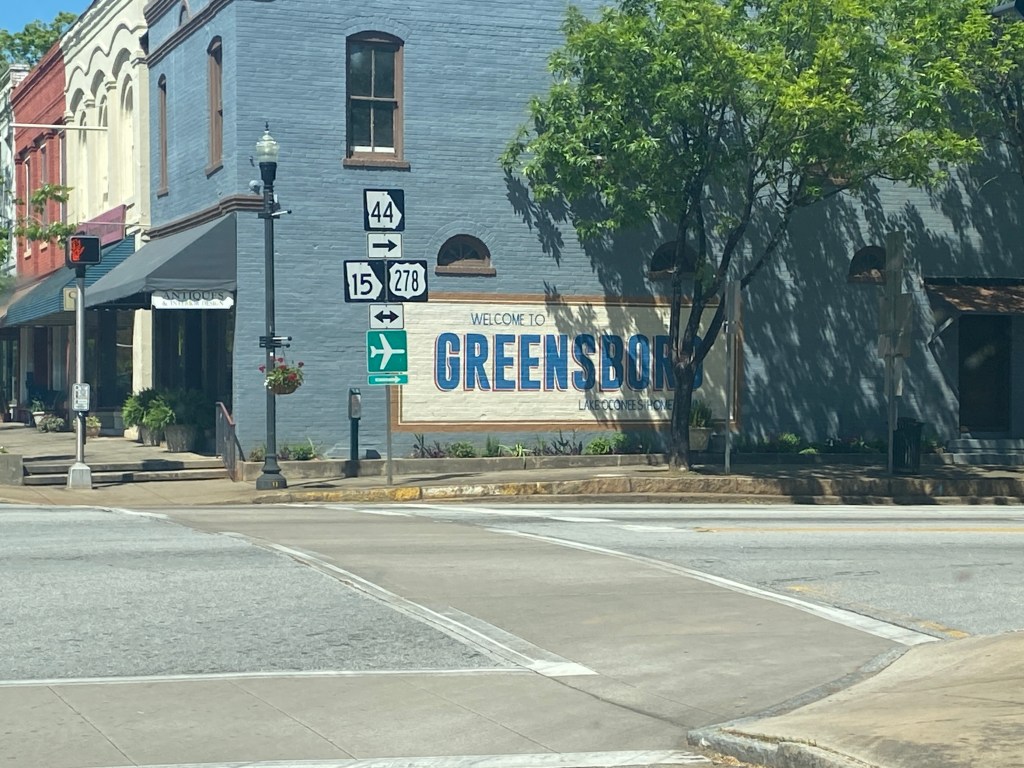
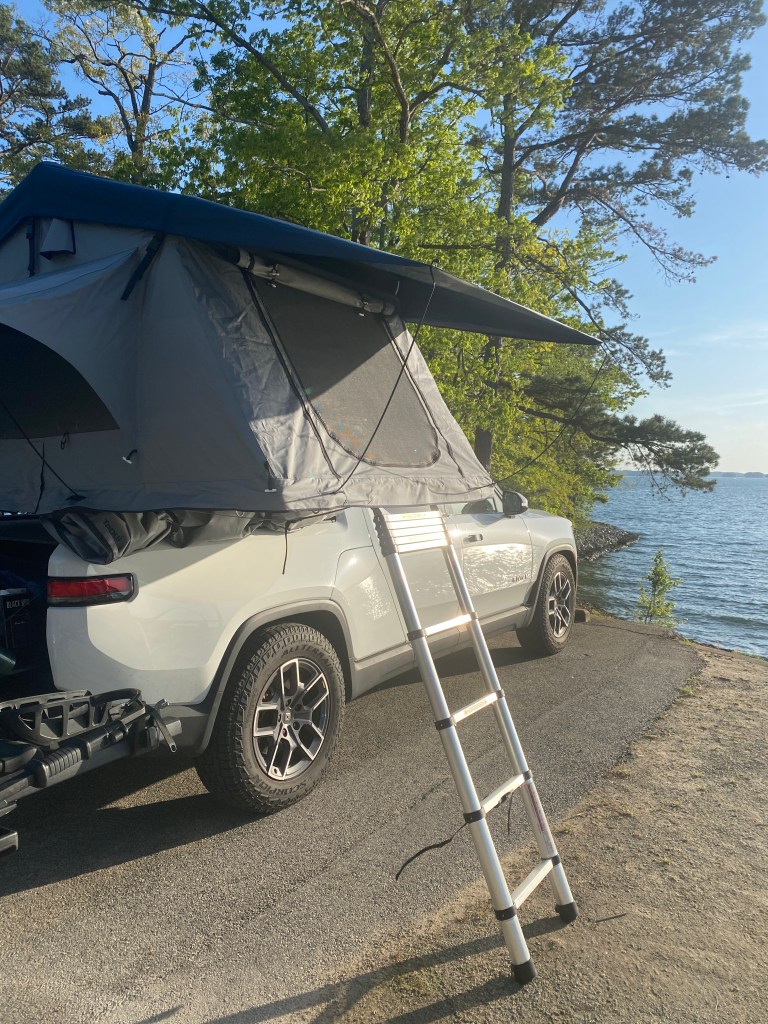
We continued through Greensboro onto Experiment Station Road and SR 8 the Atlanta Highway into Winder. In my mind all of the turns were left from Athens Street to Union Church Road to Cash Road to Credit Road onto Hog Mountain Rd and SR 13 Falcon Parkway and came upon the Atlanta Falcons IBM Performance Center. We are not there yet – onto Radford Road to Trailhead through Flowery Branch on Railroad Ave toward Chestnut Street and a right turn onto Gainesville Street eventually turns into Old Federal Road, which leads to the United States Army Corps of Engineers Campground. USACE or the COE manages water recreation areas throughout the US. We knew about the differing policies and rules from the National Park Service campgrounds and US Forest Service campgrounds policies and rules. Now we know that most COE campgrounds have curfews, which means the gate is locked from 10:30pm to 7:00am [actual times may differ from state to state].
We are gearing up to leave Atlanta in the morning – headed to Nashville for a couple of days. Keeping the rubber side down, Julie and Rob

7 responses to “…no simple highway…”
I am loving reading every email about your adventures! What memories you are making! Enjoy every minute. 💕
LikeLiked by 1 person
So awesome!
LikeLike
Thanks for your wonderful record of your journey! We love to road trip and this one made me want to hit the road! Safe travels!
LikeLiked by 1 person
Love you are using the Good ole Atlas. There is something nostalgic about that. Loved looking at it , and i loved the ending picture. Said with a smile. That works! so funny you brought back. memories of the campgrounds being closed at a certain time. I remember waking up a few HAHAHa….. Onto Nashville now I’m getting jealous. I have a free airline ticket to use before September 1st. Nashville here i come…….Im going to Nashville. kidding we are actually cleaning the ole homestead out . Its coming down May 4th. I know how you and Rob must have felt saying farewell to part of his. Very emotional for me . Ill send you pics when i get a chance. Back to work Enjoy. keep on truck
LikeLiked by 1 person
So happy to hear from you! I can totally relate to the memories of the homestead – hold on to a piece of it – but you know those memories are set forever in your family lore! Love to you and Dan!
LikeLike
Love reading the blog. With you guys in spirit.
LikeLiked by 1 person
So cool to read about your adventures! Keep the Rubber Side Down! ✌🏽
LikeLiked by 1 person